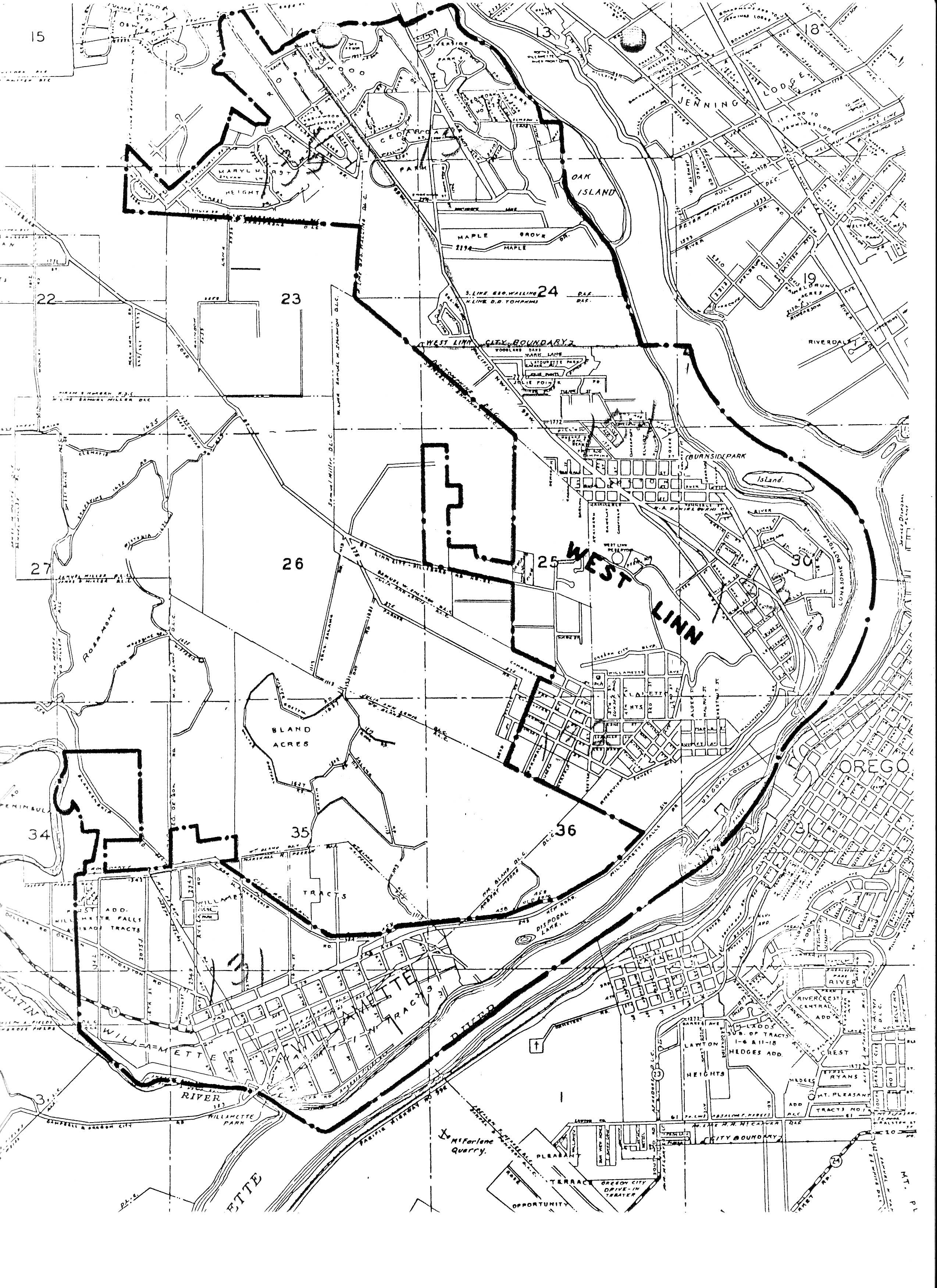
Home
Starter Site State
  • Contact Us

503-657-0331

  • Community

    Column 1

    • About West Linn
    • Residents Overview
    • Demographics
    • History
    • Mayor & City Council
    • Community Advisory Groups
    • City Meetings

    Column 2

    • Community
    • Maps
    • Videos
    • Elections
    • Emergency Preparedness
    • City Meetings
    • Social Media
    • Social Services
    • Public Access TV

    Column 3

    • Schools
    • Fire Department
    • Garbage & Recycling
    • Volunteer Opportunities
    • Neighborhoods
    • Contact the City
  • Business

    Column 1

    • Doing Business in West Linn
    • Business Resource Guide
    • Business Licensing
    • Community Partners
    • Business Grants
    • FAQs
    • Bids & RFPs

    Column 2

    • Economic Development
    • Doing Business in West Linn
    • Economic Dev. Committee
    • Tax Increment Financing (TIF)
    • Long Range Planning Projects
    • Why West Linn
    • Community Facts

    Column 3

    • Permits & Licenses
    • Business Licensing
    • Sign Permit
    • Home Occupation Permit
    • Food Trucks
    • Special Event Permit
  • Departments

    Column 1

    • City Administration
    • Communications
    • Public Records
    • Community Development
    • Building
    • Economic Development
    • Planning
    • Human Resources
    • Information Technology

    Column 2

    • Finance
    • Municipal Court
    • Utility Billing
    • Library
    • Parks & Recreation
    • Police

    Column 3

    • Public Works
    • Engineering
    • Maps/GIS
    • Water
    • Sewer
    • Stormwater
    • Streets
    • Contact the City
    • Hours of Operation
    • Report a Concern
    • Staff Directory
  • How Do I...

    Column 1

    • Apply For
    • Advisory Committee
    • Building Permit
    • Business License
    • Council or Mayor Position
    • Job
    • Library Card
    • Planning Permit
    • Recreation Classes
    • Tree Permit
    • Volunteer
    • Request
    • Building Inspection
    • City Services
    • Police Public Record
    • Public Record
    • Public Works Inspection
    • Traffic Safety Improvement

    Column 2

    • Pay Online
    • Business License
    • Court / Traffic Fee
    • Recreation Classes
    • Utility Bill
    • Find
    • Bids & RFPs
    • City Codes
    • City Events
    • City Meetings
    • Emergency Information
    • Event Space
    • Forms
    • Garbage and Recycling
    • Hours of Operation
    • Library Catalog
    • Maps
    • Neighborhood Association
    • Press Releases

    Column 3

    • Connect
    • City Council
    • City Meetings
    • City News
    • E-mail Subscriptions
    • Financial Dashboard
    • Social Media
    • Staff Directory
    • Report
    • Animal Complaint
    • Code Enforcement Request
    • Misconduct, ethics, or fraud
    • Hazard or City Issue
    • Police Tip
    • Streetlight Problem
    • Traffic Concern
    • Tree / Vegetation Complaint
    • Water / Sewer / Street Issue

Search the Website

Maps / GIS

Historic Maps

Historic West Linn Map

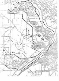
Paper maps have been scanned into West Linn's GIS and are available in digital format on this web site.

Also, use the web links on the right side of this webpage to view historic survey maps, plat maps, and more.

West Linn 1852, PDF
West Linn, 1925, R.S. Milln, Water System Map, PDF
West Linn, 1920's Detailed Water System Map Series PG1, PDF
West Linn, 1920's Detailed Water System Map Series PG2, PDF
West Linn, 1920's Detailed Water System Map Series PG3, PDF
West Linn, 1920's Detailed Water System Map Series PG4, PDF
West Linn, 1920's Detailed Water System Map Series PG5, PDF
West Linn, 1920's Detailed Water System Map Series PG6, PDF
West Linn, 1920's Detailed Water System Map Series PG7, PDF
West Linn, 1920's Detailed Water System Map Series PG8, PDF
1977 FIRM, PDF
1951 West Linn Parcel Map, PDF
1951 West Linn Parcel Map, PDF, smaller file size
1954 West Linn Street Map, PDF
1954 West Linn Street Map, PDF, smaller files size
1967 West Linn Street Map, JPG
1983 West Linn Street Map, PDF
1983 West Linn Parcel Map, PDF
1993 West Linn Parcel Map, PDF (approx. date)
1995 West Linn Zoning Map, PDF
Annexations 1913-2005 with Plats, Re-created by West Linn GIS, PDF

Related Links

Historic West Linn Plat Maps
Historic Sanborn Maps
Historic MapWorks Website
  • Printer-friendly version
  • About GIS
    • About West Linn's GIS
    • GIS Map Fees and Pricing
    • GIS Data Portal, GIS Datasets
    • GIS Map Disclaimer
    • Quick Facts about West Linn
  • Mapping Tools
    • West Linn Maps
    • Clackamas County GIS CMap
    • Land Survey Information System (CCSIS)
    • Oregon Department of Transportation (ODOT) TransGIS
    • ORMAP Assessor Tax Maps
    • HazVu Geohazards Viewer
    • Tri-Met Bus Routes Trip Planner
    • Water Rights Mapping Tool
    • Metro Maps
    • Geology and Geologic Hazards
    • Oregon Department of Transportation (ODOT) TransGIS
  • Popular Maps
    • Atlas of West Linn Oregon
    • West Linn Road Map and other Base Maps
    • City Map
    • Bike Map
    • Neighborhood Associations Maps
    • School District Maps and Bus Routes
  • Other Maps
    • Backyard Burning Boundary Map, TVF&R
    • City Owned Property Map
    • Earthquake Maps
    • Flood Insurance Maps
    • Goal 5 Inventory Maps
      • Goal 5, Local Wetland Inventory
      • Goal 5, Open Space Inventory
      • Goal 5, Significant Riparian Corridors
      • Goal 5, Wildlife Habitat Inventory
    • Historic Maps
      • Historic Resource Map
      • Historic Survey Maps
      • Historic Sanborn Maps
      • Historic West Linn Plat Maps
      • West Linn City Hall 1936 Construction Drawings
      • West Linn Railway Map
      • Willamette Historic District Inventory Maps
    • Landslide Maps
    • LiDAR Surface Model and Contours/Topo
    • Natural Hazards Mitigation Maps
    • Parade Route
    • Sandbag Locations Map
    • Stafford Basin Maps
    • Street Pavement Condition Rating Map
    • Street Sweeping
    • Street Tree Inventory Map
    • Water Main Breaks in West Linn
    • Water Resource Area (WRA) Map
    • Water System Map Pipe Age
    • Winter Weather Routes
    • Map Making Kit
    • Coloring Map
    • Zoning Map
  • Park Maps
    • Trail Maps
    • City Facilities and Parks, How to get there and Site Maps
    • Printable Map of City Parks
    • Mary S Young Park
    • Willamette River Guide
    • Palomino Loop Trail Map
    • McLean House Vicinity Map

Contact Information

Maps/GIS

  • Email:  gis@westlinnoregon.gov
  • Main Phone (Engineering):   
    503-722-5500
View Full Contact Details

Upcoming Events

  • Memorial Day - City Offices Closed
    05/26/2025 (All day)
  • Juneteenth - City Offices Closed
    06/19/2025 (All day)
  • Independence Day - City Offices Closed
    07/04/2025 (All day)
  • Labor Day - City Offices Closed
    09/01/2025 (All day)
  • Veteran's Day - City Offices Closed
    11/11/2025 (All day)
  • Thanksgiving Day - City Offices Closed
    11/26/2025 (All day)

View the Monthly Calendar

  • Home
  • Contact Us
  • Sitemap
  • Staff Login

22500 Salamo Rd. | West Linn, OR 97068

Terms & Conditions        a municode design