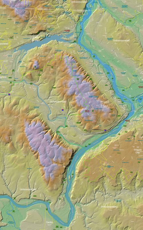
LiDAR Surface Model and Contours/Topo
LiDAR data covering West Linn is in the Public Domain and available for free download:
Download LiDAR data from the Oregon Department of Geology and Mineral Industries (DOGAMI) website:
https://www.oregon.gov/dogami/lidar/Pages/index.aspx
DOGAMI Lidar Viewer: https://gis.dogami.oregon.gov/maps/lidarviewer/
West Linn 2014 LiDAR Maps:
West Linn and Vicinity Color 2014 LiDAR Map, 36x60 pdf (Reduced File Size - 15 MB)
West Linn with Contours Color 2014 LiDAR Map, 36x48 pdf (Reduced File Size - 12 MB)
West Linn and Vicinity Color 2014 LiDAR Map, 36x60 pdf (Full Size - 150 MB - long download time)
West Linn with Contours Color 2014 LiDAR Map, 36x48 pdf (Full Size - 116 MB - long download time)
.
.
.
West Linn 2004 LiDAR Maps:
West Linn Color 2004 LiDAR Map, 11x17 pdf
West Linn Color 2004 LiDAR Map, Detailed with Contour Lines, 22x34 pdf
West Linn Black & White 2004 LiDAR Map, 11x17 pdf
West Linn Black & White 2004 LiDAR Map, 22x34 pdf